Cumberland Valley Railroad Bridge, Most kolejowy w Cumberland County, Stany Zjednoczone.
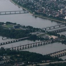
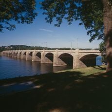
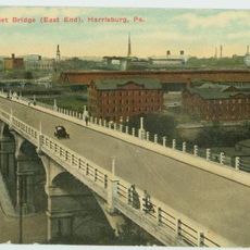
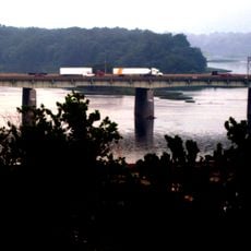
Cumberland Valley Railroad Bridge to betonowy most kolejowy przerzucony przez rzekę Susquehanna, łączący centrum Harrisburga z hrabstwem Cumberland przez City Island. Most biegnie nad wodą w szeregu łuków i ma prosty, funkcjonalny wygląd typowy dla wczesnych konstrukcji betonowych z początku XX wieku.
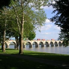
W 1839 roku w tym miejscu otwarto pierwszy drewniany most, który obsługiwał rosnący ruch kolejowy w regionie, a po kilku przebudowach zastąpiono go obecną betonową konstrukcją ukończoną w 1916 roku. Ta zmiana oznaczała przejście od dawnych budowli drewnianych i żelaznych do nowoczesnego budownictwa betonowego.
Most przebiega nad City Island, wyspą rzeczną, która dziś służy jako park publiczny chętnie odwiedzany przez rodziny z Harrisburga. Odwiedzający wyspę mogą z bliska zobaczyć stary most kolejowy, który nadal cicho góruje nad wodą między dwoma brzegami.
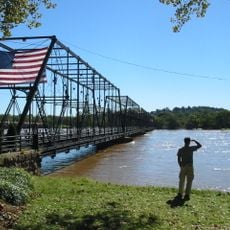
Most nie jest czynny od końca lat 80. XX wieku i nie można go pokonać pociągiem. Najlepiej widać go z City Island lub z brzegów rzeki Susquehanna, skąd cała konstrukcja jest dobrze widoczna bez przeszkód.
Wkrótce po otwarciu betonowego mostu w 1916 roku prezydent Woodrow Wilson był jednym z pierwszych, którzy go przekroczyli. Ten szczegół rzadko jest dziś wspominany, choć nadaje konstrukcji skromne, lecz prawdziwe miejsce w historii prezydentów USA.
Społeczność ciekawych świata podróżników
AroundUs gromadzi tysiące wyselekcjonowanych miejsc, lokalnych wskazówek i ukrytych perełek, wzbogacanych codziennie przez ponad 60,000 współtwórców z całego świata.