
Sundial Approx 20 Yards West Of Shortflatt Tower
Sundial Approx 20 Yards West Of Shortflatt Tower, sundial in Belsay, Northumberland, UK
Lokalizacja: Belsay
Współrzędne GPS: 55.12319,-1.87768
Najnowsza aktualizacja: 18 listopada 2025 o 00:57
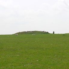
Standing stone and adjacent round cairn, 760m north east of East Shaftoe Hall
1.7 km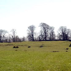
Defended settlement on Slate Hill, 300m north west of Bolam Lake
1.2 km
Garden Cottage And Stables To North West Of Shortflatt Tower
63 m
Bridge Approx 440 Yards East Of Shortflatt Tower
947 m
Sandyford Cottages Farm Buildings And Garden Walls
793 m
Bolam Castle
1.5 km
Garden Wall Attached To West Side Of Shortflatt Tower
23 m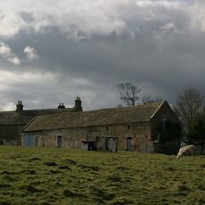
Harnham Hall
730 m
Number 2 And Attached Shed
679 m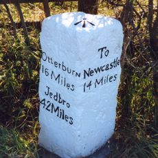
Milepost At Junction With B6309
1.9 km
Dovecote And Outbuilding Approx 30 Yards North Of Bolam Hall
1.7 km
Folly Farmhouse And Attatched Barn
1.8 km
Byre And Barn To East Of No 2
658 m
3 And 4, Harnham
573 m
Gate Piers And Walls Approx 300 Yards South-East Of Bolam Hall
1.7 km
Bowl barrow, 200m ENE of Shortflatt
736 m
1, Harnham
686 m
Milestone, 100m N of bridge over River Blythe
1.9 km
Shortflatt Tower
40 m
Defended settlement, 200m south west of Bolam Hall
1.5 km
Huckhoe palisaded enclosure, defended settlement and Romano-British settlement, 550m north east of Bolam West Houses
1.9 km
Tomb Of Katherine Babington, Wall And Statues Approx 20 Yds West Of Harnham Hall
774 m
Byres And Granary To East Of Harnham Hall
707 m
Garden Walls And Dovecote To South Of Nos 3 And 4
582 m
Armorial Beast Approx 10 Yds East Of Shortflatt Tower
62 m
Bolam Hall East Wing, And Bolam Hall West Wing
1.7 km
Wall And Gatepiers And Gate Approximately 350 Yards South West Of Bolam Hall
1.4 km
Garden Gates Approx 30 Yards East Of Shortflatt Tower
57 mRecenzje
Odwiedzili Państwo to miejsce? Kliknijcie gwiazdki, aby je ocenić i podzielić się swoimi zdjęciami lub doświadczeniem ze społecznością. Wypróbuj teraz! Możesz anulować w każdej chwili.
Odkrywaj ukryte skarby w każdej przygodzie!
Od urokliwych małych kawiarni po ukryte punkty widokowe – ucieknij od tłumów i znajdź miejsca, które naprawdę do Ciebie pasują. Nasza aplikacja ułatwia wszystko: wyszukiwanie głosowe, sprytne filtry, zoptymalizowane trasy i autentyczne wskazówki od podróżników z całego świata. Pobierz teraz i przeżyj przygodę na swoim telefonie!

Nowe podejście do odkrywania turystyki❞
— Le Figaro
Wszystkie miejsca warte odkrycia❞
— France Info
Wycieczka na miarę w zaledwie kilka kliknięć❞
— 20 Minutes