
The Chapel, Farmbuilding 70 Metres South-West Of Corridge Farmhouse
The Chapel, Farmbuilding 70 Metres South-West Of Corridge Farmhouse, agricultural structure in Wallington Demesne, Northumberland, UK
Lokalizacja: Wallington Demesne
Współrzędne GPS: 55.14645,-1.90270
Najnowsza aktualizacja: 18 listopada 2025 o 04:51
Romano-British settlement and Iron Age defended settlement, 550m north east of Shaftoe Grange
1.5 km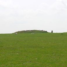
Standing stone and adjacent round cairn, 760m north east of East Shaftoe Hall
1.5 km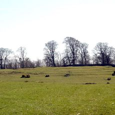
Defended settlement on Slate Hill, 300m north west of Bolam Lake
2 km
Ox Inn
1.6 km
Manse Adjacent To Congregational Church
1.6 km
Western Cottage Adjacent To Manse
1.6 km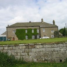
East Shaftoe Hall
1.8 km
Farmbuildings To North Of Shaftoe Grange
2 km
Outbuilding East Of Corridge Farmhouse
88 m
Corridge Farmhouse
74 m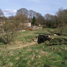
Footbridge Over Middleton Burn 60 Metres South-West Of Congregational Church
1.6 km
Henhouse And Dovecote Approx 20 Yards East Of East Shaftoe Hall
1.8 km
Shaftoe Grange
2.1 km
South Middleton medieval village and open field system
799 m
Highlaws Farmhouse
1.3 km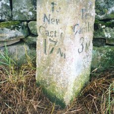
Milepost On West Side Of Road Opposite Track To Corridge
556 m
Garden Wall Adjacent To West End Of Corridge Farmhouse
62 m
Standing stone, 700m south west of Middleton South
1.8 km
Middleton Mill And Millers House
881 m
Shelter Shed And Pigsty Approx 50 Yds North Of East Shaftoe Hall
1.8 km
Walled Garden Approx 100 Yards South-West Of East Shaftoe Hall
1.9 km
Huckhoe palisaded enclosure, defended settlement and Romano-British settlement, 550m north east of Bolam West Houses
1.3 km
Garden Wall And Dovecote/Privy To East Of Corridge Farmhouse
108 m
Stable And Farmbuildings Approx 25 Yards South-East Of East Shaftoe Hall
1.8 km
Garden/Forecourt And Terrace Walls To Congregational Church And Manse
1.6 km
Eastern Cottage Adjacent To Manse
1.6 km
Congregational Church
1.6 km
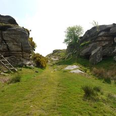
Salter's Nick
1.5 kmRecenzje
Odwiedzili Państwo to miejsce? Kliknijcie gwiazdki, aby je ocenić i podzielić się swoimi zdjęciami lub doświadczeniem ze społecznością. Wypróbuj teraz! Możesz anulować w każdej chwili.
Odkrywaj ukryte skarby w każdej przygodzie!
Od urokliwych małych kawiarni po ukryte punkty widokowe – ucieknij od tłumów i znajdź miejsca, które naprawdę do Ciebie pasują. Nasza aplikacja ułatwia wszystko: wyszukiwanie głosowe, sprytne filtry, zoptymalizowane trasy i autentyczne wskazówki od podróżników z całego świata. Pobierz teraz i przeżyj przygodę na swoim telefonie!

Nowe podejście do odkrywania turystyki❞
— Le Figaro
Wszystkie miejsca warte odkrycia❞
— France Info
Wycieczka na miarę w zaledwie kilka kliknięć❞
— 20 Minutes