
Studley Royal Park including the Ruins of Fountains Abbey
Studley Royal Park including the Ruins of Fountains Abbey, group of structures in North Yorkshire, England, UK
Lokalizacja: Lindrick with Studley Royal and Fountains
Lokalizacja: Studley Roger
Lokalizacja: Markington with Wallerthwaite
Lokalizacja: Aldfield
Lokalizacja: North Yorkshire
Strona internetowa: https://nationaltrust.org.uk/fountains-abbey-and-studley-royal-water-garden
Współrzędne GPS: 54.11611,-1.57306
Najnowsza aktualizacja: 8 marca 2025 o 23:38
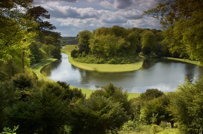

Studley Royal Park
84 m
Fountains Hall
1.1 km
Markenfield Hall
2.2 km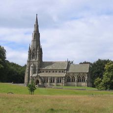
St Mary's Church, Studley Royal
542 m
Church of Saint Lawrence
1.5 km
Statue on West Side of North Crescent Pond
117 m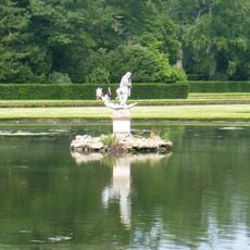
Statue of Neptune and Pedestal in Centre of Moon Pond
195 m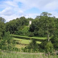
The Octagon Tower
62 m
Weir and reservoir below Tent Hill
462 m
Temple Of Piety On East Side Of Moon Pond
228 m
The Wrestlers
66 m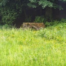
Robin Hood's Well
777 m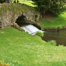
Rustic Bridge At South End Of The Canal, With Culvert And Arch To Reservoir
431 m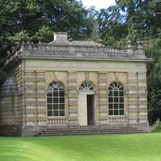
Banqueting House Approximately 100 Metres To West Of The Canal
220 m
Tunnel Approximately 20 Metres West Of The Octagon, With Flanking Wall Attached To South
49 m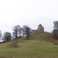
How Hill Tower
2 km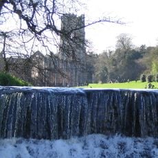
Weir At North End Of The Canal, With Piers, Fishing Pavilions And Balustrade
68 m
The Obelisk Approximately 80 Metres West Of Church Of St Mary
601 m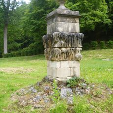
Quebec Monument
385 m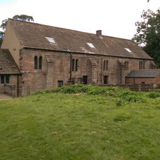
Abbey Mill
1.1 km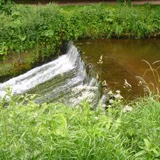
Weir On River Skell Approximately 120 Metres West Of The Reservoir
651 m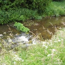
Weir On River Skell Approximately 10 Metres East Of The Infirmary At Fountains Abbey
791 m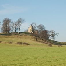
Site of medieval chapel and section of Fountains Park park pale, 170m south west of How Hill Farm
2 km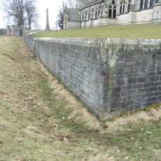
Boundary Wall With West And South Gates, Church Of St Mary
570 m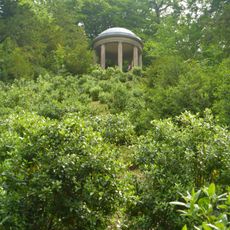
Temple Of Fame On Cliff Top At South Side Of Moon Pond
360 m
The Canal Gates And Flanking Walls On West Side Of The Lake
97 m
Stewards House, Now National Trust Restaurant And Shop
96 m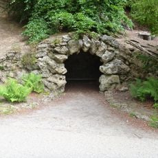
Grotto On North Side Of Reservoir
393 mRecenzje
Odwiedzili Państwo to miejsce? Kliknijcie gwiazdki, aby je ocenić i podzielić się swoimi zdjęciami lub doświadczeniem ze społecznością. Wypróbuj teraz! Możesz anulować w każdej chwili.
Odkrywaj ukryte skarby w każdej przygodzie!
Od urokliwych małych kawiarni po ukryte punkty widokowe – ucieknij od tłumów i znajdź miejsca, które naprawdę do Ciebie pasują. Nasza aplikacja ułatwia wszystko: wyszukiwanie głosowe, sprytne filtry, zoptymalizowane trasy i autentyczne wskazówki od podróżników z całego świata. Pobierz teraz i przeżyj przygodę na swoim telefonie!

Nowe podejście do odkrywania turystyki❞
— Le Figaro
Wszystkie miejsca warte odkrycia❞
— France Info
Wycieczka na miarę w zaledwie kilka kliknięć❞
— 20 Minutes