
Stone House, 200 Metres South-West Of Hackford Farm
Stone House, 200 Metres South-West Of Hackford Farm, agricultural structure in Hexhamshire, Northumberland, UK
Lokalizacja: Hexhamshire
Współrzędne GPS: 54.88238,-2.12803
Najnowsza aktualizacja: 16 listopada 2025 o 16:27
Farmbuildings 20 Metres North Of Park House Farmhouse
675 m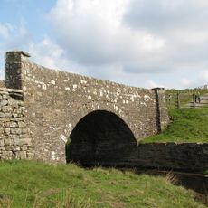
Bridge On Riddlehamhope Track 170 Metres South Of Farmhouse
3.3 km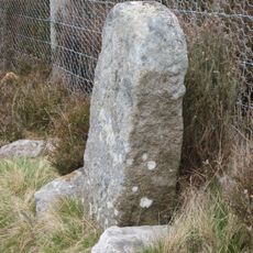
Boundary Stone At Ngr Ny 94045475
2.2 km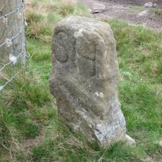
Boundary Stone At Ngr Ny 93945483, Outside Fence Corner
2.1 km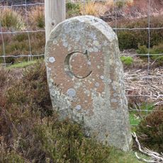
Boundary Stone 100 Metres North Of Shooting Box
3.5 km
Western House
519 m
Prehistoric hut circle settlement, farmstead and field system, 425m east of Burntshield Haugh
1.4 km
Park House Farmhouse And Adjacent Outbuilding
699 m
The Heigh Farmhouse
3.4 km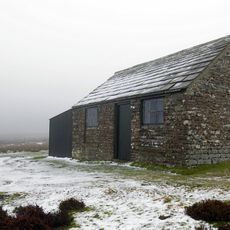
Shooting Box
3.6 km
Outbuilding 30 Metres North Of Holme House
3.1 km
Low Rawgreen Farmhouse And Attached Bastle House, And Barn
2.5 km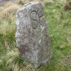
Boundary Stone At Ngr Ny 94005482
2.2 km
Turf House Farmhouse
1.6 km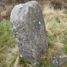
Boundary Stone At Ngr Ny 94165455, On West Of Fence
2.3 km
Burntshieldhaugh Fell prehistoric settlement and field system, 570m east of Ivy Pool
2.4 km
Harwood Shield Farmhouse
3.1 km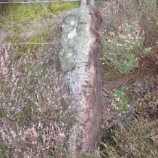
Boundary Stone At Ngr Ny 94305430
2.4 km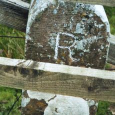
Milestone On East Side Of Riddlehamhope Track 2.5 Metres South Of Bridge
3.3 km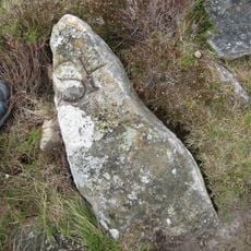
Boundary Stone At Ngr Ny 94125463, On West Of Fence
2.3 km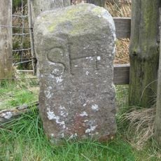
Boundary Stone At Ngr Ny 94515394, Just Within Fence Corner
2.6 km
Hut circle settlement and field system, Romano-British settlement, hush and lead ore works, 750m north east of Burntshield Haugh
952 m
Cairnfield 730m south east of Burntshield Haugh
1.9 km
Boundary Stone At Ngr Ny 95185449
3.3 km
Boundary Stone At Ngr Ny 94985435, Between Parallel Fences
3.1 km
Whitehall Methodist Chapel
986 m
Farmbuildings To West Of Harwood Shield Farmhouse
3.1 km
Raptor watchpoint
3.4 kmRecenzje
Odwiedzili Państwo to miejsce? Kliknijcie gwiazdki, aby je ocenić i podzielić się swoimi zdjęciami lub doświadczeniem ze społecznością. Wypróbuj teraz! Możesz anulować w każdej chwili.
Odkrywaj ukryte skarby w każdej przygodzie!
Od urokliwych małych kawiarni po ukryte punkty widokowe – ucieknij od tłumów i znajdź miejsca, które naprawdę do Ciebie pasują. Nasza aplikacja ułatwia wszystko: wyszukiwanie głosowe, sprytne filtry, zoptymalizowane trasy i autentyczne wskazówki od podróżników z całego świata. Pobierz teraz i przeżyj przygodę na swoim telefonie!

Nowe podejście do odkrywania turystyki❞
— Le Figaro
Wszystkie miejsca warte odkrycia❞
— France Info
Wycieczka na miarę w zaledwie kilka kliknięć❞
— 20 Minutes