128, Kings Road, building in The City of Brighton and Hove, West Sussex, UK
Lokalizacja: Brighton and Hove
Współrzędne GPS: 50.82182,-0.14993
Najnowsza aktualizacja: 21 listopada 2025 o 11:52
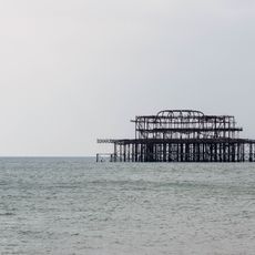
West Pier
138 m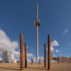
Brighton i360
138 m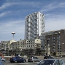
Sussex Heights
109 m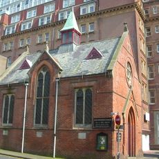
French Protestant Church, Brighton
36 m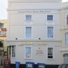
The Regency Tavern
146 m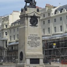
Royal Sussex Regt Boer War Memorial
55 m
Shelter Opposite The Metropole Hotel
109 m
2, 3 and 4, Regency Square
98 m
Shelter Facing The End Of Preston Street
119 m
Numbers 5-20 And Attached Railings
123 m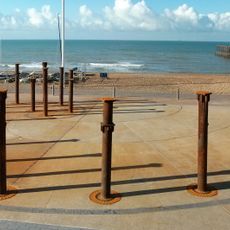
The Golden Spiral
78 m
Numbers 60-66 And Attached Railings
53 m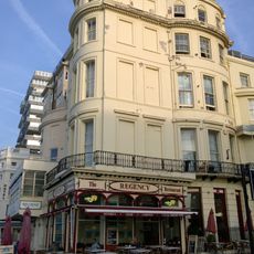
131, Kings Road
96 m
Numbers 57 And 58 And 59 And Attached Railings
76 m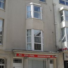
5, Preston Street
144 m
Numbers 51-56 And Attached Railings
110 m
Numbers 47 And 48 And 49 And Attached Railings
129 m
46A, Regency Square
152 m
46B, Regency Square
137 m
Numbers 125 And 126 And Attached Railings
13 m
31 And 32, Cannon Place
158 m
Numbers 38-46 Including Carriage Arch And Attached Railings
149 m
Two Bollards In The Passage Next To The Regency Tavern
149 m
35, Russell Square
147 m
Numbers 36-45 And Attached Railings
158 m
Number 79 And Attached Railings
139 m
Rampion Offshore Wind Farm Visitor Centre
54 m
Upside Down House ticket office
158 mRecenzje
Odwiedzili Państwo to miejsce? Kliknijcie gwiazdki, aby je ocenić i podzielić się swoimi zdjęciami lub doświadczeniem ze społecznością. Wypróbuj teraz! Możesz anulować w każdej chwili.
Odkrywaj ukryte skarby w każdej przygodzie!
Od urokliwych małych kawiarni po ukryte punkty widokowe – ucieknij od tłumów i znajdź miejsca, które naprawdę do Ciebie pasują. Nasza aplikacja ułatwia wszystko: wyszukiwanie głosowe, sprytne filtry, zoptymalizowane trasy i autentyczne wskazówki od podróżników z całego świata. Pobierz teraz i przeżyj przygodę na swoim telefonie!

Nowe podejście do odkrywania turystyki❞
— Le Figaro
Wszystkie miejsca warte odkrycia❞
— France Info
Wycieczka na miarę w zaledwie kilka kliknięć❞
— 20 Minutes