
All Saints Church Of England School, building in Maidstone, Kent, UK
Lokalizacja: Maidstone
Współrzędne GPS: 51.26983,0.52294
Najnowsza aktualizacja: 30 listopada 2025 o 08:57
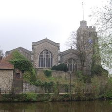
All Saints Church, Maidstone
139 m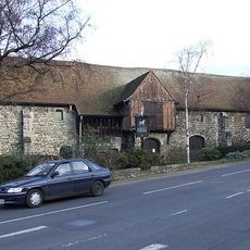
Tithe Barn, Maidstone
174 m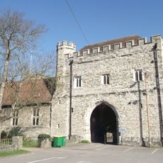
College of All Saints, Maidstone
91 m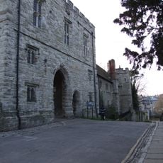
The College Gateway (All Saints Parish Room) The College Tower
89 m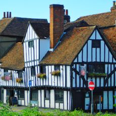
70 Lower Stone Street
170 m
The Master's Tower
61 m
50, Lower Stone Street
183 m
46, Lower Stone Street
184 m
6-10, Knightrider Street
152 m
Corrall's Charity Almshouses
170 m
52 And 54, Lower Stone Street
180 m
58-68, Lower Stone Street
172 m
44, Lower Stone Street
187 m
Knightrider House
114 m
The College
89 m
Archbishop's Stables Carriage Museum The Tithe Barn
173 m
56, Lower Stone Street
178 m
Cutbush Almshouses
66 m
Wren's Cross
152 m
Ruined Gateway
74 m
15, Knightrider Street
120 m
North Boundary Wall Formerly To Digons
64 m
East Boundary Wall Formerly To Digons
81 m
Wall to North and West of All Saints Church
168 m
Monckton War Memorial in All Saints Churchyard
125 m
The Dungeons at the Archbishop's Palace
170 m
Hermitage Millennium Amphitheatre
130 m
Orange marble orb
111 mRecenzje
Odwiedzili Państwo to miejsce? Kliknijcie gwiazdki, aby je ocenić i podzielić się swoimi zdjęciami lub doświadczeniem ze społecznością. Wypróbuj teraz! Możesz anulować w każdej chwili.
Odkrywaj ukryte skarby w każdej przygodzie!
Od urokliwych małych kawiarni po ukryte punkty widokowe – ucieknij od tłumów i znajdź miejsca, które naprawdę do Ciebie pasują. Nasza aplikacja ułatwia wszystko: wyszukiwanie głosowe, sprytne filtry, zoptymalizowane trasy i autentyczne wskazówki od podróżników z całego świata. Pobierz teraz i przeżyj przygodę na swoim telefonie!

Nowe podejście do odkrywania turystyki❞
— Le Figaro
Wszystkie miejsca warte odkrycia❞
— France Info
Wycieczka na miarę w zaledwie kilka kliknięć❞
— 20 Minutes